


Taking Lake Superior (by Goldwing), Day 2
or, covering a lot of ground


On most road trips I’ve done or can imagine, you have to strike a balance between sightseeing and covering miles. At the start of Day 2, we’d been goofing around on the Keweenaw, and we didn’t leave that island paradise until 1pm. It was time to get moving.
From Houghton to Marquette lie towns we’d been through before. And in fact, Graham has done this whole circle tour before, so he’s seen and done it all, and I’d seen it all up to Marquette. Our friend Nagel had lived in Marquette long ago while he was doing his best at a job killing sea lampreys, and we had visited him.
Passing through towns like Baraga, L’Anse and Bovine (no cows in sight), we talked over the relaxed approach that Yoopers take toward home siding options and yard management. All of which is really discussing how life looks tough in a lot of areas. Like anywhere in the USA, there is a mix of haves and have-nots in the U.P., and the differences are emphasized in certain areas, or in areas with tougher environments (due to weather and much more). I want to say that rural areas have it tougher, but we know that big cities have plenty of evident problems too.
Perhaps in the rural areas, as much as any other factor, you understand that people with money don’t usually live right alongside the highway, which skews perceptions.
We decided to ride through downtown Marquette, which is the biggest town in the U.P. at roughly 21,000 people. We stopped at the lower ore dock, which is out of service currently (forevermore) and disconnected from its rail line.

Did I mention that mining used to be (and still remains) a big thing in the U.P. (and all around Lake Superior)? These giant ore docks appear at various ports all around Lake Superior, and they are fun to see. They are bigger than things ought to be. Railroad cars would dump their loads from the top, and the dark brown chutes would guide the ore into ships below. It used to look like this:
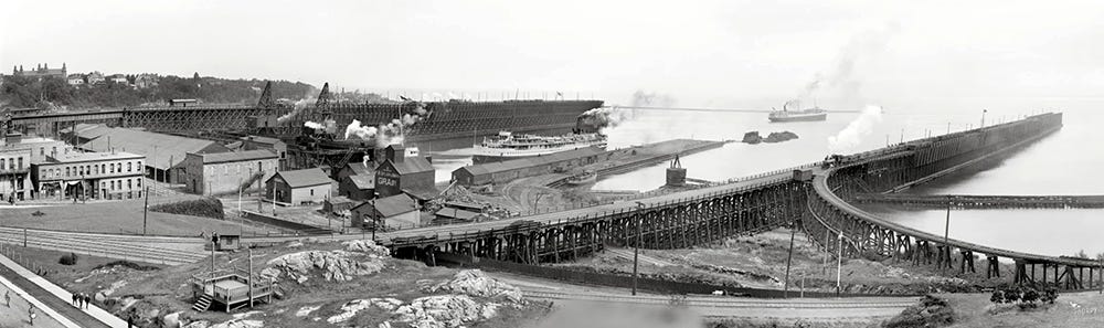
The rail line would come in from the hills and stay high above the harbor. There is still an active ore dock in Marquette north of downtown.
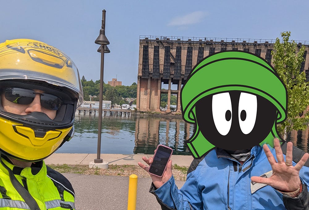
The modular helmets (i.e. the ones with the flip-up lids) make a guy look like Marvin the Martian. I’ve been thinking it all along, so I might as well say it. Despite the bulbous appearance, they really are nice for feeling a little less enclosed when taking a break, getting gas, eating, drinking, etc. But yeah … the look is …
The only other break (besides gas) we took along this stretch was in Munising, where we stopped in a back alley to make some adjustment to something and saw this scene. I really like the nondescript, random point in time, true to life, mundane shots like this. We didn’t stop to try the tacos, unfortunately.

We rode across vast swamps on the straight-arrow M-28 again. I read that one wildlife sanctuary was established here when the Canada goose was a threatened species. Boy, I sorta wish that was true again. Canada geese don’t typically add much joy to my day, let me tell you.
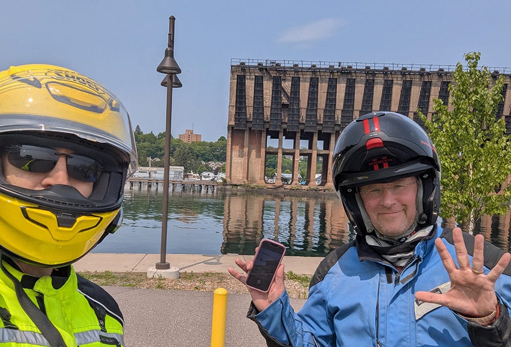
Tensions rose as we approached Sault Ste. Marie, MI (or Soo Saint Marie, for those who don’t speak Yooper). There’s always a bit of anxiety when crossing a border, and especially when going into the Dark Land. But as we rolled around town, steeling our courage before the crossing, we happened upon this mighty building:

This is the Saint Marys Falls Hydropower Plant. It is so vast that it is even bigger than Graham on Big Purple. Unbelievable, right? Pretty amazing in scope, built at a time when people built things like this. Saint Mary’s Falls is what Sault Ste. Marie translates to, by the way (Sault ~ somersault ~ rapids, etc.). I never figured that out until now, but then again, why would I have needed to?
If Duluth is the head of Lake Superior, then it falls (pun intended) to Sault Ste. Marie to be the tail, or the butt, or the end, or whatever is worse. It’s a working town. Not the most touristy on either side, but filled with industrial sights to see, which I like a lot. For whatever it’s worth, the Michigan side of SSM looks a little better off than the Ontario side, unlike what I saw in the two sides of Niagara Falls, where the Canadian side looked far better.
The crossing to Ontario was a much grander affair than I expected, with a long toll bridge (with a 30mph speed limit) beginning the journey. This bridge crosses over the locks, a spillway, and various wasteland before the passport examination station.

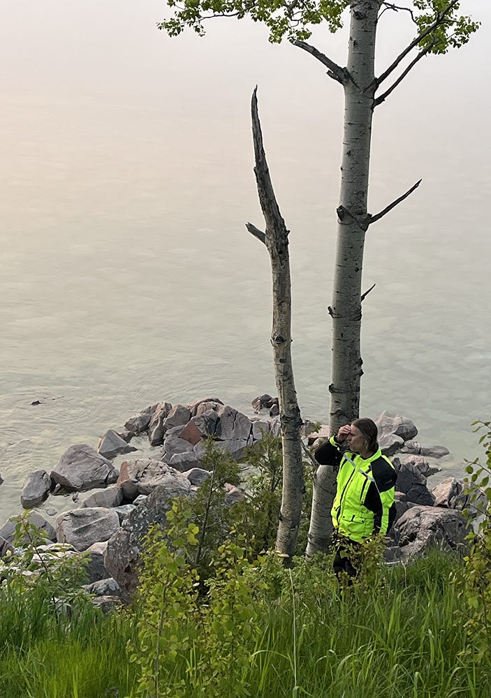
All of that went well, and we hurried to get out of town and get moving north. We decided that Wawa, ON was our goal for the night, and we made time, but also decided to stop at a scenic spot to adjust things and take a few pics.
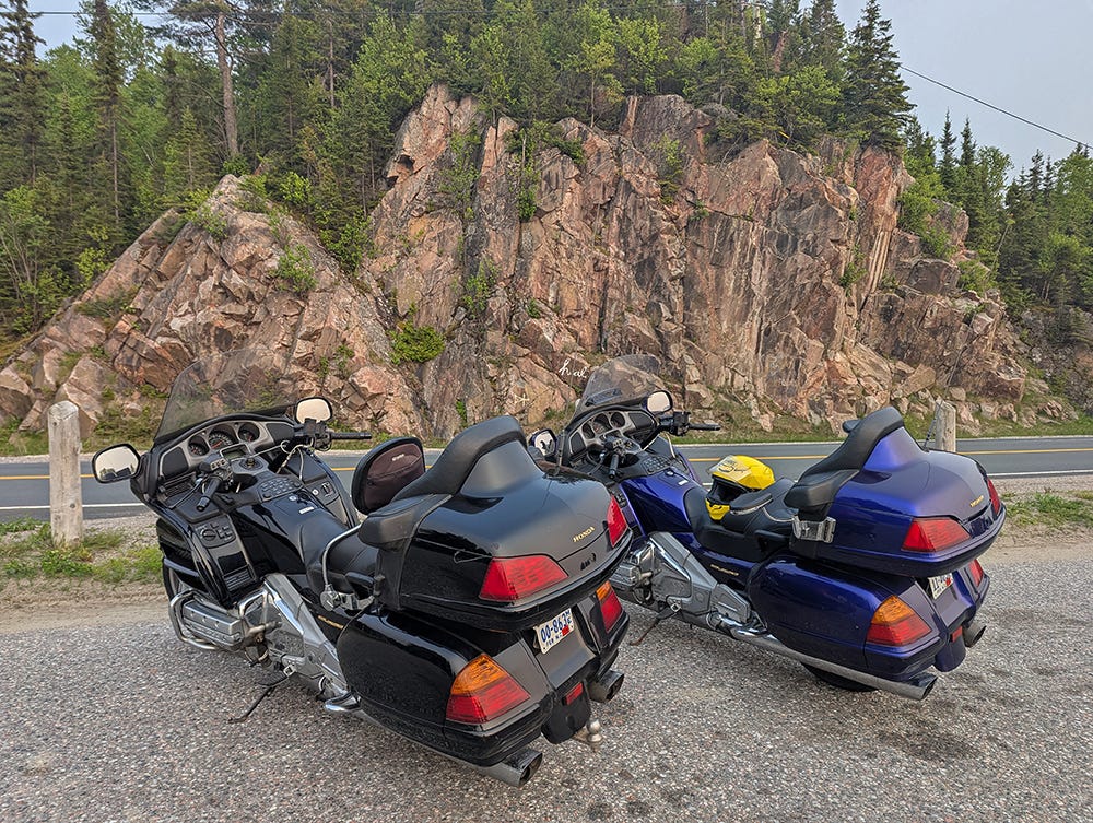
Also, worth noticing, behind the bikes, is a message worth applying to ourselves and those around us, if only possible …

We were aware that Canadian wildfire smoke might impact this trip, and while we looked at the air quality index now and again, it didn’t scare us off. We weren’t running marathons, after all. But it was clear (ha ha) that the smoke made a haze that affected a lot of the normally pristine views. I won’t say “wrecked” the views, but definitely altered, for better or worse. I suppose getting near sunset, it made things more dramatic:

Or this:
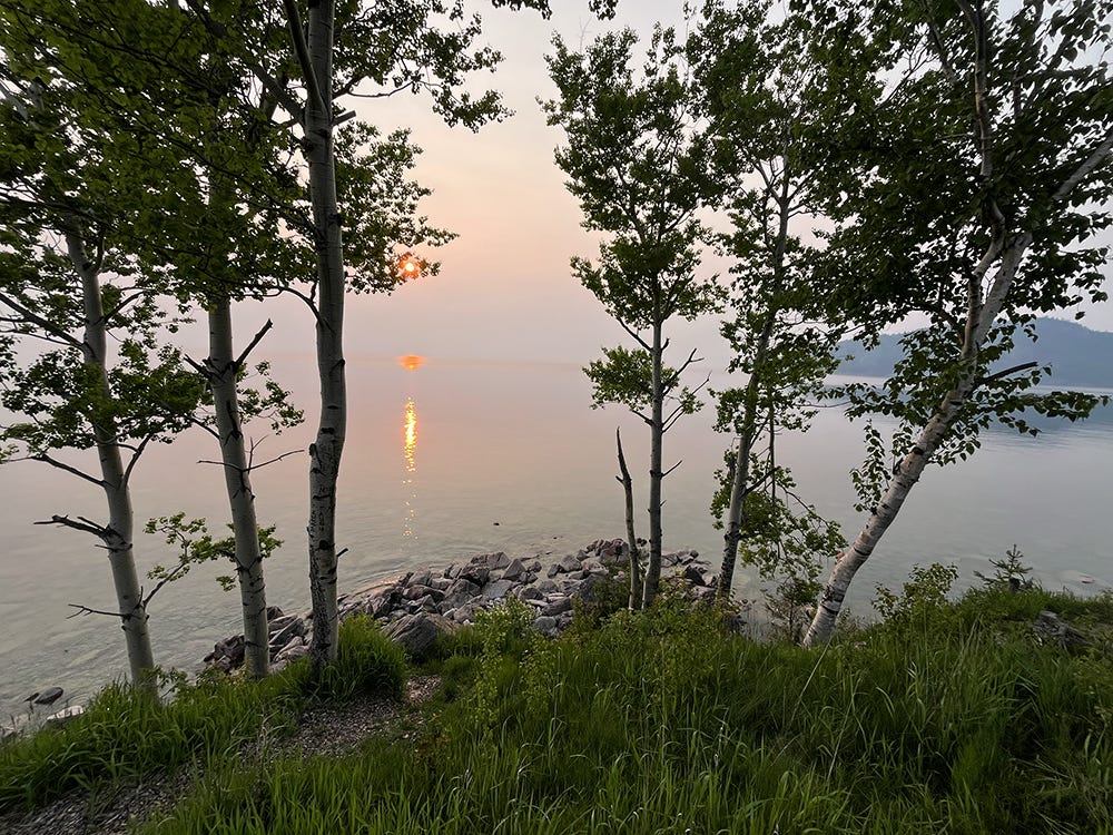
And this landscape perspective:

And this vertical take:

Graham went down the cliff a bit to get those last two nice shots, and here he is:
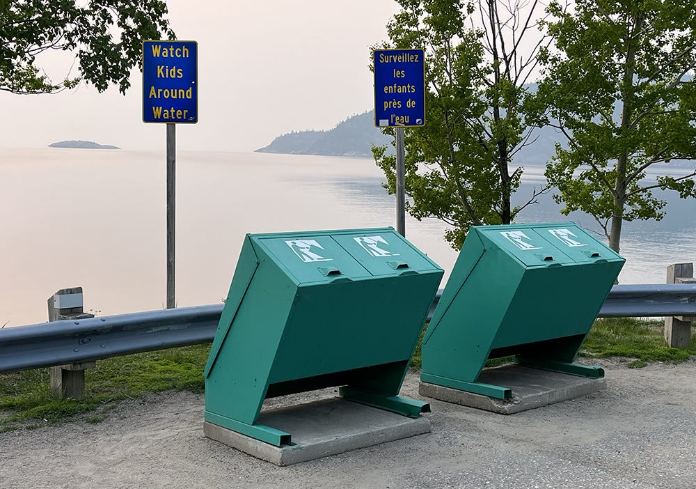
Which made the message of these signs applicable:
Despite the appearance that we lingered awhile at this spot, the thing that was most noticeable here was the swarming clouds of gnats. It was so bad I just put my helmet back on and closed the lid, but by that time, they’d already gotten in my hair, ears and eyes, and it was bad. Few things are more persistently bothersome than an itchy head when you’re wearing a balaclava and a helmet, going down twisty roads at some mostly legal speeds. Graham suggested that they bothered me more because I am sweeter, but we all know that ain’t true.
The roads on this eastern shore of Lake Superior are some of the best along the whole route. This was new territory for me, and it was fantastic! Big ups and downs, plenty of curves, very little traffic on the ON-17. One of the drawbacks may be that the road gets away from Lake Superior a bit, but when the road isn’t by the big lake, it goes along beside other lakes, which are pretty in their own right. There’s a few waterfalls and rapids and endless rivers to stop and see, if one were so inclined (and had bug nets).
This whole trip we were on the lookout for wildlife, and we saw plenty of moose warning signs, especially in this area. Lo and behold, we finally happened upon a couple youths hanging out in a swamp close to the road. This guy’s partner ran into the woods a little too quickly, but the curious laggard made the photo:

The dark woods hide the big upright ears a bit, making this moose look like a misshapen horse; then again, all moose look like misshapen livestock of some sort (or it could be that livestock look like misshapen moose). Regardless of that, we were happy to get a good look at moose in the ditch, and of course, not on the road immediately in front of us.
Without much further excitement after that, we pulled into Wawa, ready to sleep and eat. Day 2 was a long one.

As it turned out, Day 3 would be a long one too.