


Taking Lake Superior (by Goldwing), Day 1
or, Oldwings with old riders on a new adventure


As part of the contract signed by Minnesota residents, one is required to visit Lake Superior at least once a year. This demand is neither generally publicized nor discussed openly, yet people return regularly, motivated by secretive, unknown forces.
Places of power like Lake Superior draw people to them, and this trip for most may be an unrealized spiritual pilgrimage, as visiting the big lake works its magic in many ways. This is not the “purify yourself in the waters of Lake Minnetonka” nonsense that Prince used to fool Apollonia into disrobing. Rather, Lake Superior has a fundamental, overarching hold on the collective mind of Minnesotans, and paying tribute rewards those who visit. Every other lake is for practice. Lake Superior is for real, and it’s spectacular.

Whether by hiking, biking, boating, staring, glaring, or skipping stones, rituals are repeated and homage is paid. Minnesota’s North Shore is most everyone’s favorite place, with many touristy and beautiful locations available to visit, sometimes even in the same place. Less known (to Minnesotans) is the South Shore, which involves trespassing into (shudder) Wisconsin, the oddly charming U.P. of Michigan, or most dangerously, the Dark Land, by which I mean (cover the children’s eyes, please) Canada.
My buddy Graham and I have braved this godforsaken northern wasteland previously, and returned victoriously, fortified with tales of rollicking adventures and legendary bravery. Which means, among other activities, we went to Tim Horton’s. Thus, without much planning and with our usual levels of ignorance and arrogance, we set off to capture the most holy grail of Lake Superior quests — the circle tour.
Weather along Lake Superior generally takes two forms: terrible, or extra terrible. Summer appears one day per year — no one knows exactly which one it will be — and then screamingly retreats back into its hibernation cave for 364 more days of licking its wounds. In other words, weather is a gamble, so naturally we were intent on taking the most protective and safe form of transportation invented, the motorcycle.

In the history of motorcycling, no better example has been made for long-distance touring than the mighty Honda Goldwing. It has been refined over decades and its pedigree cannot be questioned. It carries endless supplies in its three trunks and treats its riders to amazing comfort. Furthermore, it has been proven that the best combination of features and value can be found in the 2003 edition. The 2003 model is so good, in fact, that Graham bought two of them. Or he hit the buy button repeatedly. I’m not sure what exactly happened, but he definitely has two Goldwings — I counted. We each had one, anyway. I did not see the titles to verify ownership, come to think of it. But here are the motorcycles, affectionally known as BIG PURPLE and BIG BLACK, and their riders, ready to set off:
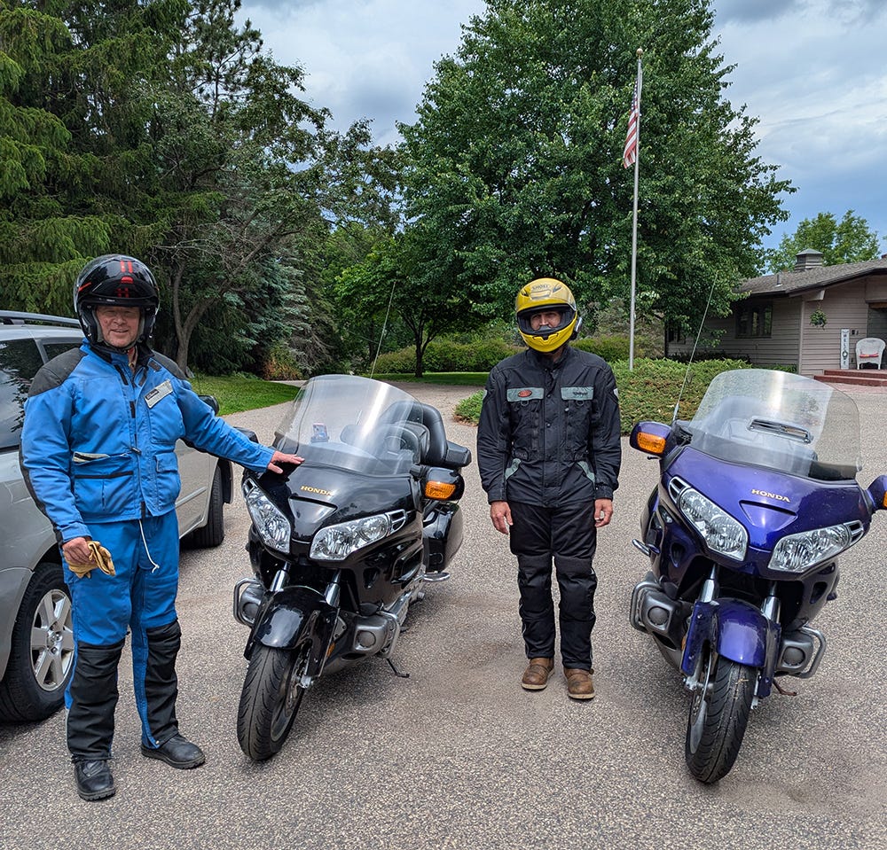
Clearly, we are both avid collectors of serious motorcycle gear. For those who are interested, I am modeling the two-piece Aerostich Roadcrafter suit, in a slimming blue color. I also have the same brand’s Combat Light riding boots and a Schuberth C4 pro carbon modular helmet with a built-in Sena SC1. Graham is sporting a svelte Firstgear Kilimanjaro jacket with color-coordinated Tourmaster Venture 2.0 slacks, along with Icon Elsinore2 boots and a daringly audacious yellow Shoei RF-1400 full-face helmet accessorized with a Sena 50s intercom. It is really all we can do to keep the ladies at bay in these outfits.
We set out from the Twin Cities in the early afternoon on Friday, with the goal of reaching the fabled Keweenaw Peninsula by nightfall. Why is it fabled, you ask? Well, it was at one time a very rich area, with a boom in copper mining that created immense wealth. Also, it gets a lot of snow, the smoked fish and pasties are great, and the street signs of Hancock are written in Finnish. How many places can you say that about, outside of Finland?
We fixed a loose, rattling brake caliper outside of Shell Lake, WI which had us worried, but after we tightened it up, we made good time along the ride northeast. Shout out to Bruce Crossing, MI, at the junction of U.S. Highway 45 and M-28 because we turned left there. M-28 is just about the straightest highway to be found in the eastern United States. Some call it boring, which it is, but high speeds may be possible, for those willing to risk the deer and slow camper traffic.

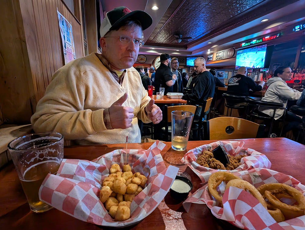
Unfortunately, we arrived in Hancock too late (partially due to the time change) to eat at any respectable (i.e. open) restaurant, but we managed to find a bar across the bridge in Houghton. By 11pm, the dinner menu was cut back to appetizers-only, then further to fried appetizers-only. Good grief. It has been proven that the best way to temper the effects of deep fried foods on one’s GI tract is to imbibe heavily, so we had no choice but to go with that plan. C'est la vie.
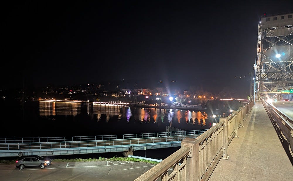
The Houghton-Hancock metropolitan area is pretty scenic, with its steep slopes and the waterway dividing the two cities underneath the Portage Lake Lift Bridge. It’s a good thing the engineers came along to dredge the canal; otherwise the bridge would make no sense at all. In the winter, the bridge is lowered and the lower deck is used by snowmobiles. Pretty sweet, eh.
A question with which we wrestled is how often to explore the offshoots of the general lake circle loop. The main roads veer away from the lake here and there, and to visit each small bit of lakeshore (or town) would be a nearly impossible task. The first area to cause us such grief was the Keweenaw itself, with the town of Copper Harbor being a nearly irresistible target. And when I say nearly, I mean truly, because off we went to ride 50 miles north, only to turn around and ride 50 miles back. As it turns out, it was so worthwhile, we almost went twice, let me tell you.
U.S. 41 through the “covered trail” south of Copper Harbor is a necessary ride or drive for anyone, and the return loop along the shore via M-26 is its equal. The loop they form could be put on repeat for days. Both roads have some ups and downs and 25mph curves that encourage enthusiastic, artistic expression in riding. Goldwings can lean a bit and have torque for days to roll on speed out of the corners. Apparently we missed the Brockway Mountain Drive, which in hindsight might be the best road of the three. Dammit … but then again … we have something to look forward to next time.
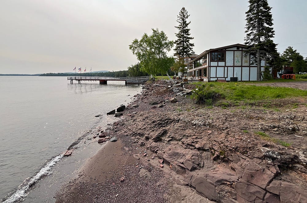
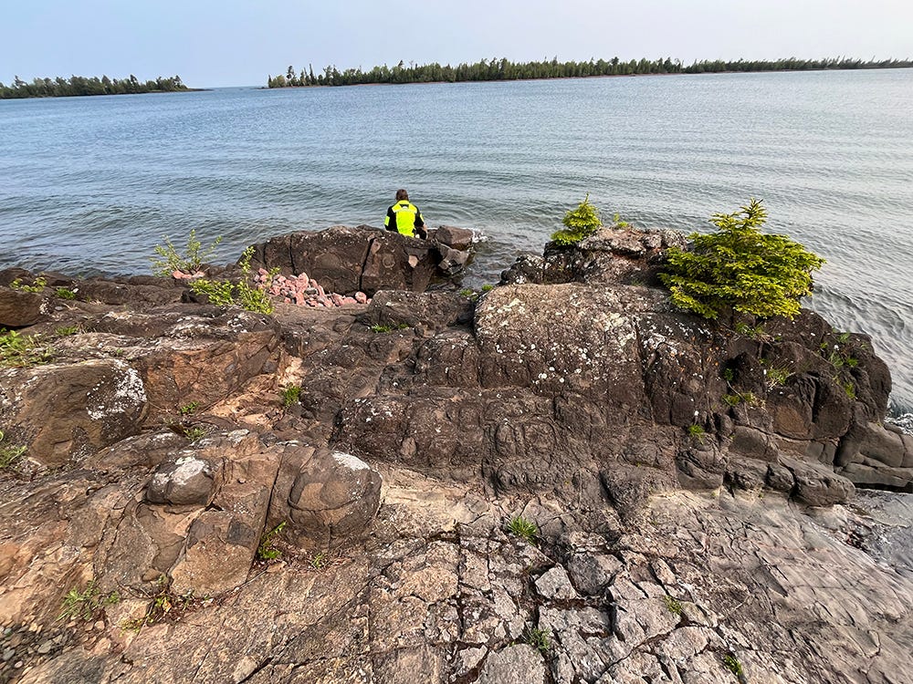
But between the roads we took in and out lies the weird mix of fancy and scrappy that is Copper Harbor. On second thought, it’s all pretty low-key, but there’s enough hidden fancy around to satisfy most visitors. We parked near the Harbor Haus restaurant and looked at the water for a bit.
Graham changed into his hi-viz jacket and hiked down to the shore:
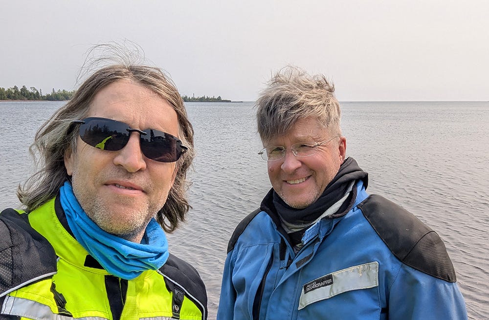
And here we are together …
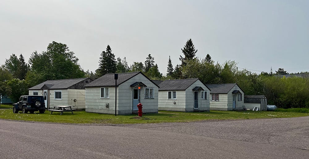
And here’s some scrappy but cozy-looking cabins operating as the North Port Motel:
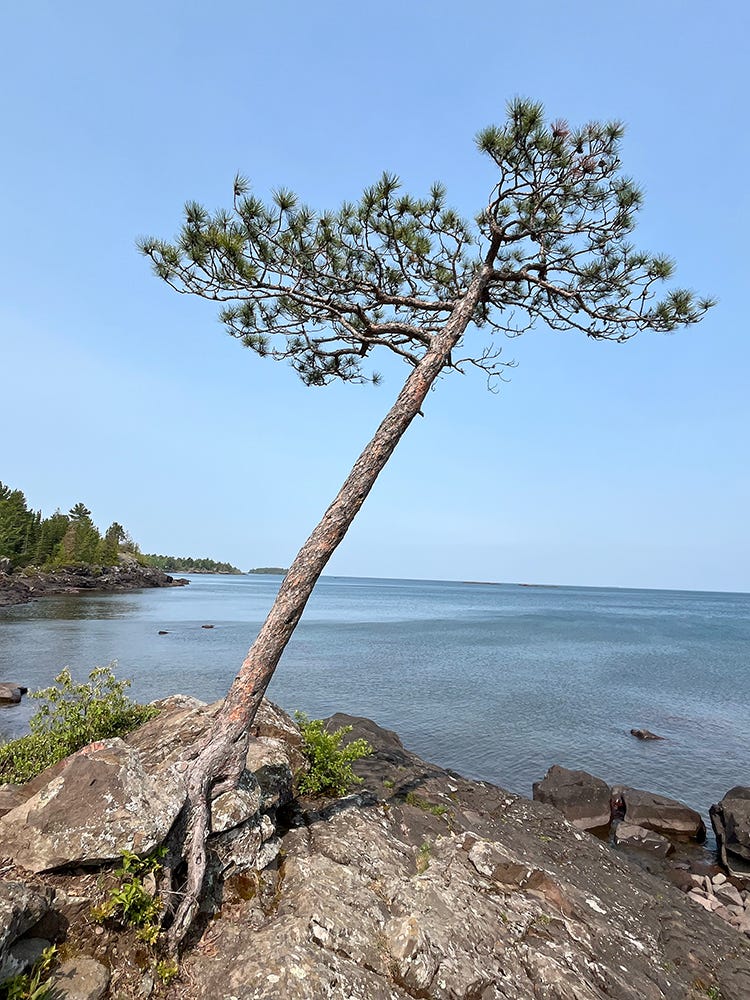
Further west out of Copper Harbor, we came to a little scenic area that required a gnarly tree pic:
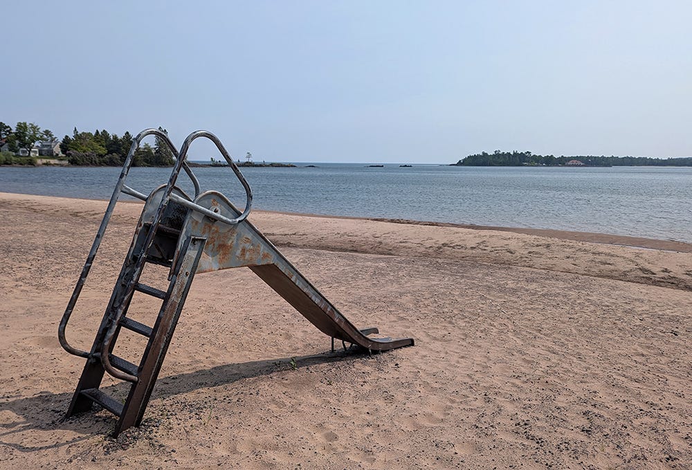
And Graham took a nice pic of this lonely metal slide in Eagle Harbor:
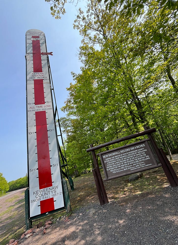
One of the iconic touristy spots on the Keweenaw is the giant snow thermometer. The highest snow total in the winter of ‘78-’79 was 390.4 inches, which is 32.5 feet. The average yearly amount is 20 feet, and last year was 27 feet. It’s a lot.
After goofing around on the Keweenaw, we had to cover some miles. Day 2 would prove to be a long one.
Man what a cool trip, and what a great way to kick it off! I love the Keweenaw and I need to get back up there one of these days. US41 into Copper Harbor really is amazing, and yes, Brockway Mountain is wonderful and you should make another trip up there to see the sunset! That Eagle Harbor beach looks familiar, I may have swam there 20 years ago on a family vacation. Another thing I love is the Quincy copper mine and tour, lots of awesome history there.